
3SES
The Shrink-Swell from Space2Earth Service (3SES) service (UC3) represents a critical climate adaptation tool aimed at informing users, namely the public, professionals, and institutions, of the current and future risk linked to the phenomena of the shrinkage and swelling of clayey soils. This service will also make it possible, using an AI assistant and a dedicated prompt, to precisely identify strengths and weaknesses of buildings subjected to this risk (information inferred from the characteristics of surroundings, construction methods, etc.). The service will also orient users toward solutions that are tailored and contextualized across different timeframes. The core version of the 3SES service will be free of charge and an alert mode is being considered for the paid version to support daily operational decision-making, an alert mode based on insights gained during the research phase of this project regarding climatic triggering factors and associated thresholds.
As this risk stems from distinct factors, the 3SES service integrates a broad set of datasets on soil and subsoil (soil typology and water table characteristics), anthropogenic data (including local/historical construction principles), climatic data (current for real-time monitoring and future for projections) and environmental data (trees, hillshade, declination, permeability rates, etc). Fully integrated into EOSC, the development of this service benefits from the expertise of the Climate-adapt4EOSC consortium, notably through the application of FAIR principles, a dedicated climate-adaptation ontology and the use of two AI assistants (satellite image analysis and a tool for comparing databases and related indicators). These AI assistants will ensure the service’s reproducibility and robustness across EU countries, notably by allowing databases to be modified to leverage the most relevant information available locally. A method for comparing databases, specifically by breaking down the parameters of the indicators themselves, is currently being developed to this end.
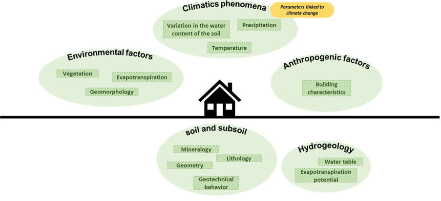
Swelling and shrinking soils principles
This risk stems from changes in the soil volume under moisture fluctuations, due to the high water retention capacity of naturally occurring clay-minerals (smectite, montmorillonite, etc.). The shrinkage or swelling of clayey soils induces dissymmetrical soil displacement under shallow-founded buildings that cause deformation on the structure and possibly damage that could lead to loss of habitability or collapse of the building and significant financial consequences. At the same time, these soil movements also cause damage to infrastructure (particularly roads, damage to the road surface) and to networks (ruptured pipes, etc.).
This hazard, which is relatively widespread across Europe, represents a major issue in areas where it is assessed and monitored (such as France and England). In France, for instance, over 50% of the territory is exposed to the risk of clay soil shrinkage and swelling, affecting more than 10 million homes, and the cost to insurers has exceeded one billion euros annually in recent years (driven by the increasing frequency and intensity of drought periods).
EOSC Readiness
Track the readiness of the 3SES Service over the three-year implementation period of the Climate-Adapt4EOSC project
3SES Resources
Online information pages and websites produced by French project partner BRGM or other reference institutions (e.g. British BGS) introduce the causes and consequences associated with this risk.
BGS – Swelling and Shrinking Soils (English)
Research Papers
Service Development Team
LNEC (Laboratório Nacional de Engenharia Civil) leads the development of OPENHIDRA, drawing on its expertise in coastal and estuarine hydrodynamic modelling, wave dynamics, coastal early-warning systems, port engineering and information technology service and platform development. OPENHIDRA is designed to help users deploy simulations to support adaptation planning and physics-based decision-making. Within the project, LNEC provides the scientific, methodological and technical input needed to ensure the service meets real user needs and integrates cleanly into the EOSC ecosystem.